Roanoke's map has 50 neighborhoods in 28 planning areas. Zillow's typical city home value was $277,549 in Sept. 2026, up 2.3% on the year.
Last checked Oct. 19, 2026. The neighborhoods on this page are the City of Roanoke’s own, from its Neighborhoods Planning map layer and the neighborhood plans listed in City Plan 2040. School zones come from the city’s elementary, middle and high school zone layers; home values from the Zillow Home Value Index (Zillow Research); population and income from the Census Bureau’s QuickFacts for Roanoke city and the 2020-2024 American Community Survey; ZIP code boundaries from Census ZCTAs.
Roanoke is an independent city of 98,355 people, separate from Roanoke County, and its own planning map divides it into 50 neighborhoods grouped into 28 planning areas. This guide covers 12 of them, chosen to span every side of the city, with a page each on schools, home values, parks, bus routes and distances.
What this means for you
- City or county: a “Roanoke” mailing address can be in the city or in Roanoke County; check the parcel first
- Schools: every city address is in Roanoke City Public Schools, split between Patrick Henry and William Fleming high schools
- Typical home value: $277,549 citywide in September 2026, according to Zillow; $147,524 to $301,322 by ZIP code
- The expressway: I-581 and U.S. 220 run north to south through the middle of the city
How the city is laid out
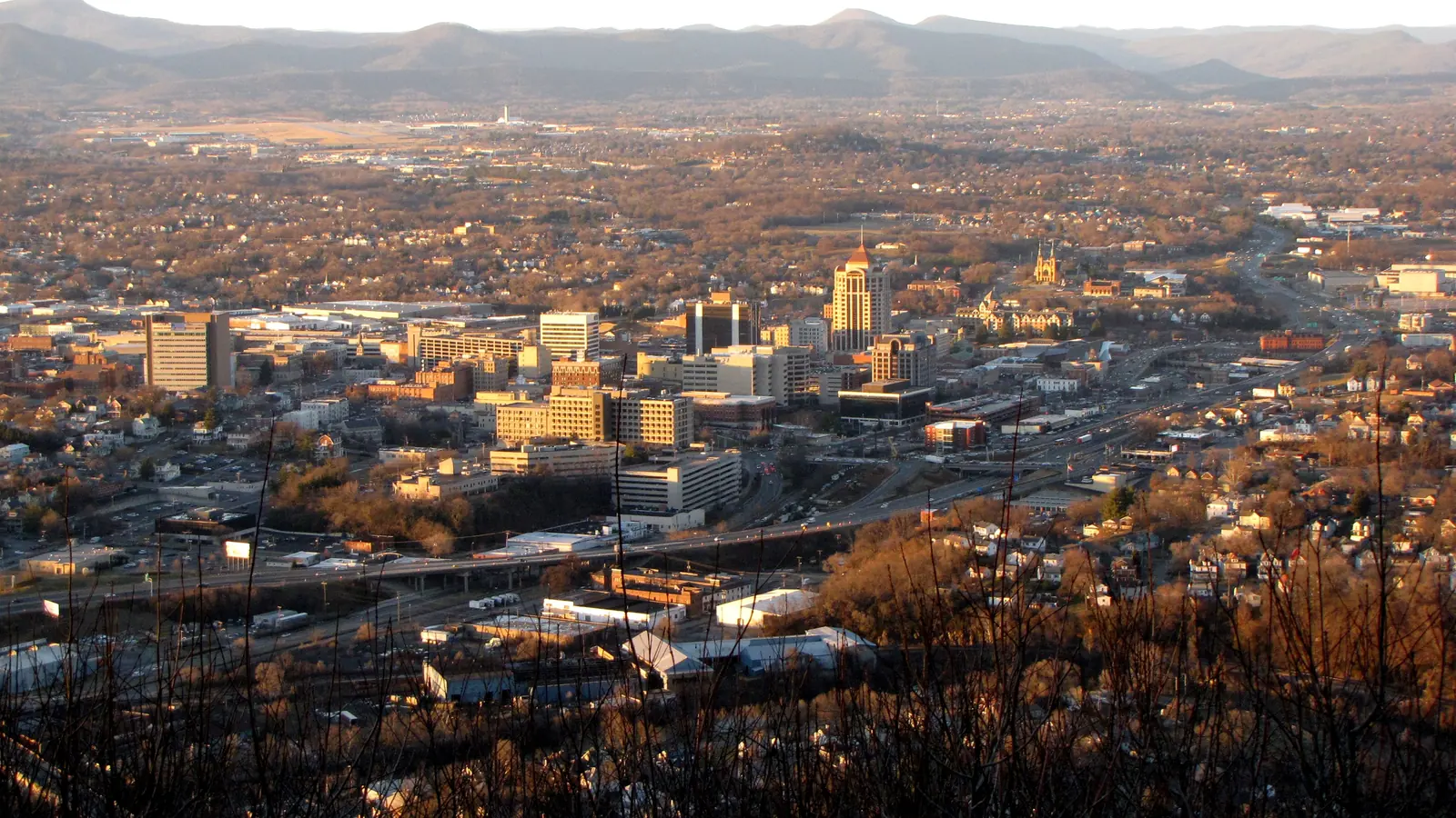
Roanoke sits in the Roanoke Valley with Mill Mountain on its southeast side. I-581, which becomes the U.S. 220 expressway south of Elm Avenue, runs north from downtown to I-81, with exits numbered 1 to 6. The Roanoke River crosses the south side from west to east. Street addresses carry a quadrant: NW, NE, SW or SE.
The city’s ZIP codes do not match its limits. 24011 is downtown; 24012, 24013, 24014, 24015, 24016, 24017 and 24019 cover most neighborhoods. By Census ZIP code areas, about half of 24012, most of 24014 and about 90% of 24019 lie in Roanoke County, and the western neighborhood of Greater Deyerle is mostly in 24018, a ZIP code that is about 94% county. School zones follow the city line, not ZIP codes: a county address goes to Roanoke County Public Schools even when the mail says Roanoke.
According to the Census Bureau’s 2020-2024 American Community Survey, the city’s median household income was $55,378, its median owner-estimated home value $190,500 and its mean travel time to work 19 minutes. Our moving to Roanoke guide and population guide have more.
Map of the neighborhoods
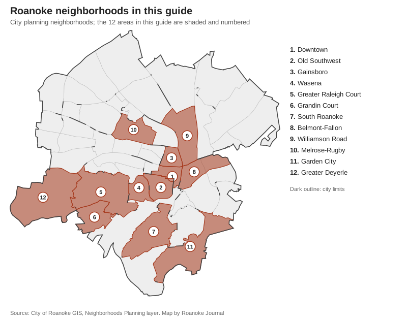
Map: Roanoke Journal, from the City of Roanoke’s Neighborhoods Planning layer.
The neighborhoods at a glance
Home values are Zillow’s Home Value Index for the ZIP code that covers most of each area, for September 2026. “Split” means the high school line runs through the area.
| Area | Main ZIP | Zoned high school | Typical value in that ZIP | Guide |
|---|---|---|---|---|
| Downtown | 24011 | Fleming (80%), Patrick Henry (20%) | not published for 24011; 24016: $166,240 | Downtown |
| Old Southwest | 24016 | Patrick Henry (79%), Fleming (21%) | $166,240 | Old Southwest |
| Gainsboro | 24016 | Patrick Henry (95%), Fleming (5%) | $166,240 | Gainsboro |
| Wasena | 24015 | Patrick Henry | $301,322 | Wasena |
| Greater Raleigh Court | 24015 | Patrick Henry | $301,322 | Greater Raleigh Court |
| Grandin Court | 24015 | Patrick Henry | $301,322 | Grandin Court |
| South Roanoke | 24014 | Patrick Henry | $294,071 | South Roanoke |
| Belmont-Fallon | 24013 | Fleming (79%), Patrick Henry (21%) | $147,524 | Belmont-Fallon |
| Williamson Road | 24012 | Fleming | $229,041 | Williamson Road |
| Melrose-Rugby | 24017 | Fleming (85%), Patrick Henry (15%) | $185,382 | Melrose-Rugby |
| Garden City | 24014 | Patrick Henry | $294,071 | Garden City |
| Greater Deyerle | 24018 | Patrick Henry | $375,478 (mostly county) | Greater Deyerle |
Home values by ZIP code
| ZIP code | September 2026 | September 2025 | Change |
|---|---|---|---|
| 24019 | $308,239 | $298,242 | up 3.4% |
| 24015 | $301,322 | $298,207 | up 1% |
| 24014 | $294,071 | $284,259 | up 3.5% |
| 24012 | $229,041 | $228,078 | up 0.4% |
| 24017 | $185,382 | $182,767 | up 1.4% |
| 24016 | $166,240 | $166,121 | up 0.1% |
| 24013 | $147,524 | $152,121 | down 3% |
| Roanoke (Zillow city figure) | $277,549 | $271,382 | up 2.3% |
The index is Zillow’s modeled typical value for the middle third of homes, not a sale price, and Zillow revises past months. ZIP codes 24019, 24014 and 24012 include many county homes. See our home prices guide for the longer trend.
The areas
Downtown (230 acres): the City Market, City Hall and Valley Metro’s 3rd St Station, where every city bus route starts; the Roanoke Co+op is on Market Square.
Old Southwest (383 acres): the grid of streets around the 32.8-acre Highland Park, about 87% inside the city’s H-2 historic overlay; zoned mostly for Highland Park Elementary.
Gainsboro (236 acres): north of downtown, with Hotel Roanoke, St. Andrew’s Catholic Church and the Gainsboro Branch Library; served by seven Valley Metro route pairs.
Wasena (306 acres): on the Roanoke River, with Wasena and Smith parks and the Roanoke River Greenway; zoned for Wasena Elementary.
Greater Raleigh Court (1,368 acres): the west side along Grandin Road, Memorial and Brandon avenues, with Raleigh Court and Lakewood parks; four elementary zones.
Grandin Court (527 acres): on the county line along Brambleton Avenue, with most of Fishburn Park, a recreation center and Patrick Henry High.
South Roanoke (1,014 acres): between the river and Mill Mountain, almost all zoned for Crystal Spring Elementary, with River’s Edge Park.
Belmont-Fallon (545 acres): east of downtown, with the 64-acre Fallon Park and the Tinker Creek Greenway.
Williamson Road (844 acres): the U.S. 11 corridor north of downtown, about 3.4 miles by road from the airport, with the Berglund Center at its south end.
Melrose-Rugby (547 acres): northwest Roanoke, with Kennedy, Eureka and Staunton parks and the Eureka Recreation Center.
Garden City (1,262 acres): the southeast corner below Mill Mountain, with the Yellow Mountain reserve and the Garden City Greenway.
Greater Deyerle (1,738 acres): the city’s largest planning neighborhood, mostly suburban lots, with two-thirds of its edge on the county line.
Schools
Roanoke City Public Schools runs 17 elementary, five middle and two high schools, and every city address is zoned for one of each. The high school line between Patrick Henry and William Fleming runs through Downtown, Old Southwest, Gainsboro, Belmont-Fallon and Melrose-Rugby, and elementary zones split most of the larger areas. Each area page lists its zones with the share of the area in each, and our schools guide has the state ratings. Always check one address on the Attendance Zone Locator.
Comparing Roanoke with its neighbors
Our Roanoke vs Salem vs Vinton vs Roanoke County guide sets tax rates, high school results, home values and services side by side.
How we built this
- The areas are the City of Roanoke’s planning neighborhoods, by the names on its map. Where the city plans two neighborhoods together (Belmont and Fallon), we kept them together. We wrote pages for 12 of the 50, chosen to cover every quadrant; the rest are on the map above.
- Smaller place names inside an area (Virginia Heights, Crystal Spring, Oakland) come from OpenStreetMap place records (© OpenStreetMap contributors). We name no subdivision that the city or OpenStreetMap does not list as a place.
- School shares are the share of each area’s land in each zone on the city’s zone layers, not a count of homes.
- ZIP shares come from Census ZIP Code Tabulation Areas laid over the city’s boundaries.
- Distances are measured on the road network with OSRM routing on OpenStreetMap data, from the middle of each area; they are not drive times.
- Bus routes are from Valley Metro’s published route feed, dated Oct. 17, 2026.
Frequently asked questions
How many neighborhoods are in Roanoke, Virginia?
The city’s planning map divides Roanoke into 50 neighborhoods grouped into 28 planning areas, from Downtown and Old Southwest to Greater Deyerle, Garden City and the Williamson Road area.
What ZIP codes are in Roanoke city?
Most city addresses are in 24011, 24012, 24013, 24014, 24015, 24016, 24017 or 24019, with a small part of 24022. Several of these reach into Roanoke County, so a Roanoke mailing address does not always mean the home is in the city.
Do all Roanoke neighborhoods go to the same high school?
No. Roanoke City Public Schools has two high schools, Patrick Henry and William Fleming, and the line between them runs through several neighborhoods, including Downtown, Old Southwest, Belmont-Fallon and Melrose-Rugby. Check one address on the division’s Attendance Zone Locator.
Is a Roanoke address in the city or Roanoke County?
Roanoke is an independent city, not part of Roanoke County. Homes with a Roanoke mailing address can be in either. Search the parcel on the city’s GIS map; if it is in the county, county taxes and Roanoke County Public Schools apply.
What is the typical home value in Roanoke?
Zillow’s Home Value Index for Roanoke was $277,549 in September 2026, up 2.3% from a year earlier. By ZIP code it ranged from $147,524 in 24013 to $301,322 in 24015. These are modeled values, not sale prices.
Have your say